The Costa Brava’s Best-Kept Secret: 7 Quiet Road Cycling Routes for Total Serenity
Discover 7 hidden quiet road cycling routes on the Costa Brava for total serenity—smooth tarmac, sea views, and minimal traffic. Ride in peace.
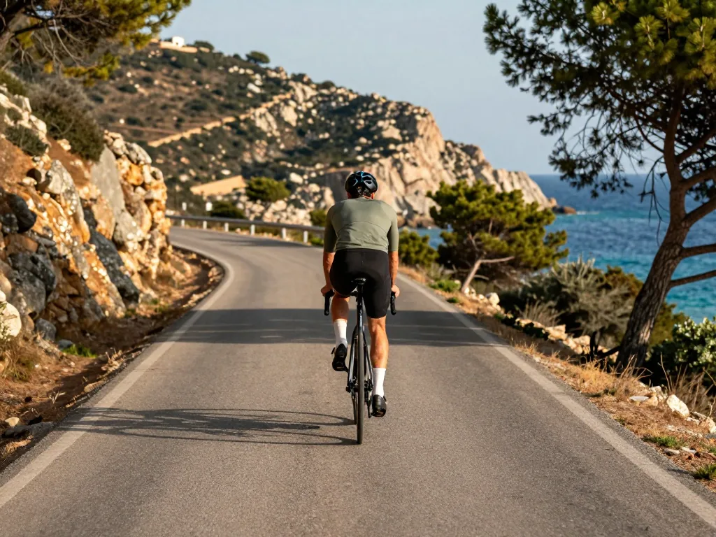
The Costa Brava is famous for crowded coves, bustling resorts, and lively promenades. For cyclists, however, its true magic lies far from the asphalt chaos. Most riders stick to the well-known coastal highway, but a network of silent, winding roads threads through cork oak forests, hidden vineyards, and forgotten hillside villages—offering pure solitude on two wheels. This guide unveils seven off-the-radar routes, chosen for minimal traffic, smooth surfaces, and uninterrupted views. Whether you’re a seasoned climber chasing empty tarmac or a leisure rider after meditative miles, you’ll find a ready-made map to the region’s quietest cycling experiences.
Understanding the Quiet Cycling Landscape
Why the Costa Brava’s Inland Roads Are a Hidden Gem
The region’s true cycling treasure lies inland, not along the postcard coastline. A labyrinth of secondary roads—carreteres locals—and agricultural pistes weaves through the Gavarres, Albera, and Montgrí ranges. These are no sweeping, sea-view switchbacks from glossy magazines. They are narrow, undulating ribbons of tarmac beneath cork oaks and pines, linking forgotten stone villages and hermitages. Their quietude sets them apart. Far from tourist corridors, you’ll share the asphalt with little more than a tractor hauling olives or a dog napping in the sun. The network stays peaceful year-round, but especially outside the July and August crush, when coastal towns swell and the interior sits blissfully empty. Your soundtrack: the crunch of tyres and a distant church bell.
Key Traffic Patterns and Seasonal Timing
For serenity, understanding traffic flow is half the battle. The C-31 and GI-682, the main coastal arteries, funnel holidaymakers between Blanes and Cadaqués—avoid them entirely. Instead, target April through June and September through October. Tourist traffic drops, temperatures hover at a pleasant 18–24°C, and the hills glow with golden, soft light. A few practical realities:
- Expect farm vehicles and occasional livestock inland, especially in the Albera range, where sheep and cattle crossings are common—ride with patience and a bell.
- Early mornings, before 9 AM, are quietest on all secondary roads; the air is cool, and the tarmac often still damp with dew.
- Weekdays beat weekends by a wide margin, particularly near the coast, where Girona and Barcelona weekenders drive out for lunch. A Tuesday morning through the Gavarres feels private and solitary; a Sunday afternoon on the same route brings a handful of cars. Plan for total solitude.
Essential Bike Setup and Gear for Quiet Routes
Tire and Gearing Considerations
The Costa Brava’s quiet roads mix surfaces, so your setup should match. Most routes are fully paved, but the quality swings from smooth new tarmac to older, patched asphalt with cracked edges. A road bike with wider tires—28mm or more—hits the sweet spot. The extra volume absorbs vibration on rougher stretches and gives confident grip on shaded descents where damp leaves or loose grit collect. If you plan to ride the Via Verde greenway, an old railway line from Girona down to Sant Feliu de Guíxols, rethink your setup entirely. That route isn’t for narrow racing tires; its compacted dirt and fine gravel demand a gravel bike, cyclocross bike, or anything with 35–40mm tires. As for gearing, the inland climbs—especially around the Gavarres massif—are steady but relentless. A compact chainset (50/34) with an 11-34 cassette keeps you spinning on gradients that hold at 6–8% for long stretches. Skip a standard 39/53 chainset unless you’re a seasoned climber; otherwise, you’ll be walking before the summit.
Navigation and Safety Essentials
“On quiet roads, self-reliance is key: carry a physical map or a downloaded offline route, as mobile signal can be patchy in the mountain passes.”
That’s not a scare tactic—it’s practical reality. The Albera range and the inland valleys between Girona and the coast are gloriously remote, but that means no café or petrol station around every corner. Pack extra water and calorie-dense snacks; services are sparse inland, and a 100km loop may pass only two small villages. A basic repair kit—two spare tubes, tire levers, a multi-tool, and a reliable mini-pump—is non-negotiable. Think about visibility too. Even on a sunny midday ride, keep a rear light flashing. The narrow lanes in the Albera range often lack shoulders, and while traffic is rare, a local driver or delivery van can appear suddenly around a blind bend. A front light helps on the Via Verde’s short tunnels, which are unlit and disorienting even in daylight. Finally, use a handlebar bag or small frame bag to keep your phone, map, and snacks within reach—fumbling in a jersey pocket while climbing a quiet pass is unsafe and unnecessary.
Route One: The Gavarres Massif Climb to Sant Grau
Starting from Santa Cristina d’Aro
Leave the coastal hum of Platja d’Aro behind and pedal inland from the quiet, tree-lined streets of Santa Cristina d’Aro. Within ten minutes, the sea breeze fades and the air thickens with the scent of cork oak and pine. The road to Sant Grau is a smooth ribbon of asphalt that climbs steadily, but never brutally, into the Gavarres massif—a protected, forested range that feels a world away from the beach crowds. This is not a climb for the pure climber; it’s a rhythm-building ascent of roughly 8 kilometers, with gradients that hover between 4% and 6%, occasionally kicking to 8% on the final switchbacks. The surface is immaculate, with no potholes to dodge and, crucially, almost no motorized traffic. On a weekday morning, you might share the road with a single farmer’s van and a handful of wild boar tracks. The payoff comes as the trees part: panoramic views over the deep green valleys toward the Mediterranean, with the Montgrí massif and the Illes Medes visible on a clear day. This is a route that rewards steady effort rather than explosive power, making it an ideal first inland ride for intermediate cyclists who want to test their legs without the intimidation of the coastal passes.
The Descent and Return Options
At the Sant Grau viewpoint—a small stone chapel and picnic area—you have two choices. The simplest is to turn around and retrace the climb, enjoying a fast, flowing descent on the same quiet tarmac. The road is wide enough for confident cornering, and with zero traffic pressure, you can focus on your lines and braking points. For a more substantial ride, continue on the loop that drops toward Romanyà de la Selva. This connection is slightly narrower and more technical, with tighter switchbacks and a few sections of broken surface where tree roots have pushed through. It’s not dangerous, but it demands attention. The descent into Romanyà is a highlight: a shaded, sinuous drop that opens onto rolling farmland before a gentle climb back toward Santa Cristina. Depending on your chosen loop, the total distance ranges from 30 to 40 kilometers, with around 500 to 700 meters of elevation gain. Plan for a half-day, pack a snack for the chapel, and bring a wind vest—the summit can be breezy even when the coast is calm. This is cycling for the love of quiet, not for Strava heroics.
Route Two: Romanyà de la Selva to Palamós
The Quiet Corridor Through the Forest
Want to feel the Costa Brava as it was before the coastal highways arrived? This is the route. You start in the medieval stone village of Romanyà de la Selva, perched high in the Gavarres massif, then drop straight onto a road that feels like a private driveway. It’s paved and well-maintained, yet so lightly used you might ride ten minutes without seeing a car. The road winds down through the heart of the Gavarres—a protected forest of dense cork oaks that canopy overhead like a green tunnel. On a July afternoon, that shade isn’t a luxury; it’s survival. The surface stays smooth, but fallen cork bark and pine needles dot the tarmac, so keep your hands loose on the hoods and watch for the odd wild boar darting across. The gradient rolls gently toward the sea, though short, punchy rises remind your legs you’re still in the mountains. The real reward is the silence: no horns, no tour buses, just cicadas buzzing and tyres crunching on asphalt.
Connecting to the Coast Without the Crowds
Most riders head straight for Palamós’s busy port and the GI-682, which turns into a parade of campervans by late morning. This route skips that entirely. Instead, the descent spits you out at the quieter, northern edge of Palamós, near Platja de la Fosca. Roll to a stop, put a foot down, and listen to the waves—no beach bar in earshot. The route ends before the congestion starts, giving you a clean, calm spot to refill bottles and turn around. Ride early, ideally by 8:00 AM, because even the quiet northern arc sees a slow creep of traffic by noon. The full loop, returning via the same corridor, spans 25 to 35 kilometres, depending on whether you add the short detour to the ruined Iberian settlement at Castell de la Fosca. The climb back is steady but never brutal, and the payoff is that same forest silence in reverse. For a peaceful half-day on two wheels, this is the Costa Brava at its most serene.
Route Three: The GI-653 from Palamós to La Bisbal d’Empordà
A Secondary Road with Scenic Farmland
Looking for a classic, quiet escape from the crowded coastal highway? The GI-653 delivers. This well-maintained secondary road links the port town of Palamós to the medieval heart of La Bisbal d’Empordà, rewarding riders who favour rural rhythm over seaside chaos. Signage is clear, and traffic is typically light—especially on weekday mornings. You leave the sea behind almost at once, swapping salt spray for pine and wild herbs as the road threads through rolling hills and patchwork farmland.
The climb is steady and moderate, never brutal, but persistent enough to wake up your legs. As altitude builds, golden fields and stone farmhouses unfold below—the essence of the Baix Empordà. Around ten kilometres in, the road crests, then eases into a long, sweeping descent onto the fertile Empordà plain. Here, the effort pays off: minutes of coasting, the horizon wide before you, until you roll into La Bisbal, famed for ceramics and its weekly antiques market.
Extending into the Empordà Plain
Arriving at La Bisbal doesn’t have to mean the end. It’s the perfect springboard onto the flat, agricultural lanes stretching north toward the Montgrí massif. These roads are what make Costa Brava cycling so rewarding—silent, nearly car-free, lined with irrigation canals and, in summer, sunflower fields. The extension builds distance without adding climbing; you can ride as little or as much as you like, with the Montgrí castle’s silhouette as your constant anchor.
The out-and-back from Palamós to La Bisbal runs roughly 20–25 kilometres each way. Turn around there and you’ll face the climb again—but reversed, it feels entirely new. Prefer a loop? Head north to Ullà, then east to Torroella de Montgrí, pick up the quiet GI-652 back toward the coast at L’Estartit, and swing south to Palamós. That adds about 30 extra kilometres of serene riding. Pack a windproof gilet—the plain gets breezy—and carry at least two bottles; services between towns are scarce.
Route Four: The GI-644 from Torroella de Montgrí to L’Estartit
A Flat, Scenic Link to the Coast
Locals ride this route when they want the sea breeze without earning it. The GI-644 is a quiet, mostly flat road that unspools for roughly 8 to 10 kilometers between the medieval grandeur of Torroella de Montgrí and the low-key coastal resort of L’Estartit. Smooth asphalt runs parallel to the Montgrí massif—a rugged limestone ridge that rises abruptly from the plain, crowned by the 14th-century castle of Montgrí, which you’ll catch glimpses of above your left shoulder. To your right, the Mediterranean glitters through pine groves and low scrub, appearing and disappearing as the road gently bends. Traffic is sparse, especially on weekday mornings; you’ll share the tarmac with the occasional local car heading to the beach and the odd tractor. The gradient never exceeds 2%, making this the perfect warm-up spin before tackling the massif’s steeper interior climbs—or a restorative recovery day when your legs are begging for mercy. Two small roundabouts near L’Estartit’s marina are easily navigable, and once you reach the waterfront, reward yourself with an espresso at a beachfront café before turning around.
Combining with the Montgrí Massif Loop
To truly escape, don’t stop at the coast. Turn inland just before L’Estartit and follow the quiet agricultural lanes that wrap around the massif’s northern flank. This extension adds 20 to 30 kilometers of dead-flat, traffic-free riding that feels like a secret handshake among local cyclists. The road narrows to a single lane, bordered by drainage channels and wild reeds, and soon you’ll enter the Aiguamolls de l’Empordà Natural Park—a protected wetland and one of Catalonia’s most important bird sanctuaries. Here, the only sounds are the croak of frogs, the rustle of herons taking flight, and the soft hum of your tires on the asphalt. Wooden birdwatching hides invite you to stop, clip out, and scan the lagoons for purple herons, glossy ibis, and the occasional flamingo. The route is almost entirely flat, with only the faintest undulations, and you’ll encounter just the occasional farm vehicle hauling produce. It’s a ride of profound solitude—no souvenir shops, no tour buses, just you, the sky, and the silent, watchful mountains. For a longer day, link this loop with the GI-644 outbound and return via the inland lanes, creating a 40- to 50-kilometer circuit that delivers a rare combination of coastal light and wild, marshy calm.
Route Five: The Via Verde Greenway from Girona to Sant Feliu de Guíxols
A Traffic-Free Railway Path
The Via Verde is the Costa Brava’s answer to a zen-like cycling day. This rare ribbon of calm follows the abandoned narrow-gauge railway line that once linked Girona’s inland capital with the coastal town of Sant Feliu de Guíxols. What sets it apart is the total absence of motor traffic—no impatient drivers, no exhaust fumes, just the soft crunch of wheels on compacted gravel and dirt. The gradient stays gentle throughout, a legacy of the railway engineers who carved this path through the Gavarres hills. That makes it ideal for intermediate cyclists who want to cover ground without grinding up punishing climbs. Still, leave the featherweight racing bike with slick 23mm tyres at home; the surface demands something sturdier. A road bike with 28mm or wider tyres—or a light gravel bike—will glide over the packed stone comfortably. You’ll thank yourself when you emerge from a tunnel into dappled cork-oak shade, the sea breeze mingling with wild rosemary.
Practical Notes for the Greenway
- The full one-way distance is roughly 40 kilometers. The profile is mostly flat, but several old railway tunnels add a cool, dark punctuation to the ride—bring a small front light or use your phone torch for the longer ones.
- Access points appear frequently, with small villages and car parks at regular intervals. You can easily shorten the ride to 15 or 20 kilometers for a half-day outing; just check local signage for the nearest exit.
- Carry a bell. This is a shared path, and walkers—especially families with children—are common on weekends. A gentle ring from a distance keeps everyone relaxed.
- Surface conditions shift with the seasons. Expect a fine layer of dust in July and August that coats your chain, and watch for slick mud patches after autumn rains. Plan your gearing and tyre pressure accordingly, and consider a frame bag with a small cloth to wipe down your drivetrain at the end.
The route ends at Sant Feliu de Guíxols, where you can reward yourself with a swim in the calm bay or a coffee at a harbourside café. Then catch a local train back to Girona with your bike—a perfect, serene loop that leaves you with nothing but quiet satisfaction.
Route Six: The Empordà Plain Agricultural Roads
The Flat Network Between Montgrí and the Aiguamolls
This isn’t one ribbon of tarmac but a web of quiet agricultural lanes stitching together the vast, open Empordà plain. Sandwiched between the Montgrí massif’s hulking silhouette to the north and the Aiguamolls de l’Empordà Natural Park’s reed beds to the east, the network offers riding profoundly different from coastal climbs. The roads are gloriously flat, often surfaced with smooth asphalt laid for farm access, and see virtually no motor traffic beyond the odd tractor. Here, the steady-state rider rules: turn off your brain, find a rhythm, and pedal for hours beneath an enormous sky that stretches toward the Pyrenees on the horizon. There’s no climbing to speak of—just the gentle, hypnotic hum of tyres and the distant call of egrets from the wetlands.
Navigating the Maze of Lanes
The Empordà plain is a labyrinth of farm tracks; use a GPS or a detailed map, as signposting is minimal, and the flat landscape can disorient even experienced riders.
Don’t underestimate navigation. With few landmarks and summer fields of maize or sunflowers rising high overhead, losing your bearings is remarkably easy. A pre-loaded GPS route is non-negotiable. For the best experience, plan a 40-to-60-kilometer loop starting from the medieval town of Torroella de Montgrí at the massif’s foot, or from the pottery town of La Bisbal d’Empordà to the west. From Torroella, head east toward the park’s buffer zone, weave north through the tiny hamlets of Ullà and Bellcaire, then cut back inland on lanes running parallel to the Ter River. With zero elevation, this suits building endurance on a long day in the saddle—or a deeply restorative recovery ride after punishing Gavarres hills. Stop at a roadside farm stand for fresh fruit, and listen: the only sound will be wind in the poplar trees.
Route Seven: The Albera Range via GI-602 and GI-603
A Remote Mountain Challenge Near the French Border
If your definition of serenity means zero traffic and a landscape that feels genuinely wild, the Albera Range delivers. Tucked into Catalonia’s far northeastern corner, minutes from France, this is the Costa Brava’s true backcountry. The GI-602 and GI-603 are narrow paved ribbons that climb through cork oak forests and over windswept ridges, often without a guardrail in sight. The asphalt is cracked and patched, the shoulders all but gone, and your only company might be a stray dog or a farmer’s tractor. That’s the point. Here, you hear your own breathing, the crunch of tyres, and distant sheep bells. The views—Mediterranean on one side, Pyrenean foothills on the other—are spectacular, and they belong to those willing to embrace the isolation.
Advanced Considerations for the Albera
This is no casual spin. The Albera demands respect. Expect steep, sustained gradients that force you out of the saddle, and rough tarmac that keeps you sharp. Traffic is nearly absent, but the hazards are organic: mud from farm vehicles, loose gravel, and herds blocking the road around blind bends. Ride here only if you’re experienced, self-sufficient, and confident on technical descents.
- Carry extra food and water: No villages, fountains, or bars exist on the GI-602 or GI-603. Once you leave the last settlement below, you’re alone. Pack at least two bidons and more energy bars than you think you’ll need.
- Brake early on the descent: Downhills are fast but tricky. Corners tighten without warning, and shaded stretches can be slick with pine needles or damp moss. Feather your brakes well before the apex, and never follow a car’s line.
- Ride in spring or autumn: Summer heat at lower elevations is brutal—still, humid air with no relief. Aim for April to June or September to October, when temperatures are crisp and the light turns golden.
- Gear down: A 50/34 with an 11-28 cassette won’t cut it. Use a compact crankset with a wide-range cassette (11-32 or larger) for the sustained 12–14% pitches. You’ll thank yourself on the final climb to the Coll de Banyuls.
Planning Your Self-Guided or Lightly Supported Ride
Thoughtful sequencing unlocks the Costa Brava’s quietest roads. You don’t want to waste daylight shuttling between start points, nor climb the same coastal pass twice. With a little planning, these seven routes stitch into a seamless, serene escape.
Creating a Multi-Day Itinerary
For a 3–5 day trip, treat the region’s three geological personalities as your chapters. Begin with the Gavarres (Routes 1 and 2), forested, rolling hills inland from the busy coast. Their shaded, low-traffic lanes warm up your legs and ease you into the area’s rhythm. Next, transition to the Empordà plain (Routes 3 and 4), where terrain flattens into vineyards and sunflower fields, with long, uninterrupted sightlines to the Pyrenees. Finish with either the Via Verde (Route 5)—a car-free former railway line that’s a gentle, restorative pedal—or the more demanding Albera (Route 7), where climbs reward you with panoramic Gulf of Roses views.
To minimize transfers, base yourself centrally, in La Bisbal d’Empordà or Torroella de Montgrí. Both sit within a 20–30 minute drive of every route start, so you can leave the car parked for days and ride from your hotel door. La Bisbal, with its weekly antiques market and arcaded square, feels more authentic; Torroella offers easier coastal and Montgrí massif access. For five days, plan two in the Gavarres, one long day on the plain, and two split between the Via Verde and the Albera, with a rest day or shorter loop in between.
Logistics for Lightly Supported Rides
Prefer a lightly supported trip—ideal for covering more ground without a heavy pack? Arrange luggage transfer between accommodations. Most local cycling tour operators offer this from €25 to €45 per day, per bag, and will move your bike if you’re not riding daily. A support vehicle proves invaluable here: have it carry extra water, spare tubes, and a cooler of snacks. It can leapfrog ahead to a scenic viewpoint or village café, leaving you to ride unencumbered.
For fully self-guided rides, start early—the golden rule. By 8:30 AM, the tarmac is yours, and you’ll beat the midday heat, which in July and August can push past 30°C (86°F) on exposed climbs. Carry at least two 750ml bottles per person, plus a third for the Albera. And remember: many rural bars close between 2 PM and 5 PM, so stock up at the first village you pass. A small handlebar bag with a banana and a gel can mean the difference between a serene ride and a bonk.
Frequently asked questions
What makes a road cycling route 'quiet' on the Costa Brava?
Quiet routes here typically avoid the busy N-II and coastal C-31 highways, instead using secondary paved roads that run inland through cork oak forests, vineyards, and small hilltop villages. These roads have light local traffic, especially outside July and August, and often feature smooth asphalt with rolling climbs rather than steep mountain passes.
When is the best time of year to ride these quiet routes?
Late spring (May–June) and early autumn (September–October) offer the best balance of mild temperatures, low tourist traffic, and dry roads. Summer mornings before 9 a.m. are also workable, but afternoons bring heat and more camper vans near coastal access points. Winter rides are possible but expect cooler temperatures and occasional rain, especially in December and January.
How do I find routes that avoid the busiest coastal sections?
Look for routes that start inland from towns like Girona, La Bisbal d’Empordà, or Banyoles, then link quiet valleys such as the Gavarres massif or the Baix Empordà plain. Avoid the coastal road between Blanes and Tossa de Mar, and the section from Palamós to Calella de Palafrugell, which are narrow and crowded. Instead, use the ‘Caminos de Ronda’ only for short scenic detours, not as main route segments.
Are there any flat quiet routes suitable for beginners?
Yes, the flat farmland roads around the Ter River delta near Torroella de Montgrí and the Empordà wetlands offer long, straight, and nearly traffic-free riding. Another option is the loop around the Banyoles Lake, which is mostly flat and paved, with a dedicated cycling lane for part of the route. These areas rarely see heavy traffic, even in peak season.
What kind of road surface should I expect on quiet routes?
Most quiet routes use well-maintained secondary asphalt, but some sections, especially those through forested hills, may have patches of gravel or broken edges after winter. Expect occasional cattle grids and narrow sections with no shoulder, but the surface is generally smooth enough for road bikes with 25mm tires or wider. Avoid routes marked as ‘camins de terra’ (dirt paths) unless you have a gravel bike.
Are there any mandatory safety considerations specific to this region?
Always carry water and food, as quiet routes pass through villages with limited opening hours, especially in the afternoon (many shops close from 2–5 p.m.). Watch for tractors during harvest season (September–October) on rural roads, and be cautious of wild boar crossings at dawn and dusk, particularly near forested areas. Also, note that some quiet climbs have steep gradients (10–14%) without guardrails, so descend with care.
Can I combine quiet routes with a visit to the coast without riding on busy roads?
Yes, you can ride quiet inland routes that end at small, less-visited coves like Cala Montjoi or Aiguablava, where the final approach is a short, low-traffic descent. For example, a route from Pals to Begur via Regencós uses quiet interior roads and then drops down to the coast at Sa Riera. Avoid the main coastal road, but use the small connector roads that run parallel to it, often just a few hundred meters inland.
Are there any organized quiet-route networks or signage I should look for?
The ‘Vies Verdes’ (greenways) include the Carrilet route from Girona to Sant Feliu de Guíxols, which is fully paved and traffic-free, though it is more of a gravel/path mix in places. For road cycling, look for the ‘Ruta del Ter’ and ‘Ruta de l’Empordà’ signposted loops, but they are not consistently marked. Most locals use GPS tracks from cycling apps, as official signage for quiet road routes is sparse.
How much climbing is typical on a medium-length quiet route (60–80 km)?
Expect 600–1,200 meters of elevation gain, depending on whether you stay on the plains or dip into the Gavarres hills. A flat route along the Empordà plain might have only 200–300 meters, while a loop from Girona through Madremanya and Peratallada will include several short, punchy climbs of 1–3 km each. The climbs are rarely sustained, so they are manageable for intermediate riders.
What should I know about navigation and mobile coverage on these routes?
Coverage is generally good on the plains but can be patchy in the Gavarres and around the Montgrí massif, so download offline maps before you go. Many quiet routes lack clear signage, so a GPS device or phone with a pre-loaded route is essential. Also, carry a physical map as a backup, as some rural intersections have no signs at all.