Girona to the Wild: The Ultimate Gravel Route Through Spain’s Hidden Natural Park
Discover the ultimate gravel route from Girona to Spain’s hidden natural park—wild trails, stunning landscapes, and pure adventure await.
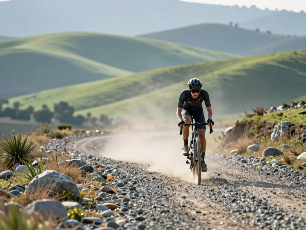
Forget the crowded Costa Brava beaches—the real Catalonia lies inland, where cork oak forests blanket ancient hills and the only soundtrack is the crunch of gravel beneath your tires. This guide hands you a complete, self-supported plan for a gravel route from Girona’s medieval streets into the wild heart of the Parc Natural de les Gavarres, a hidden gem of coastal ridges and silent valleys. You’ll get the full logistics—from route logistics and terrain breakdowns to navigation tips and practical prep—so you can focus on the ride itself. Whether you’re chasing a challenging one-day loop or stretching it into a relaxed multi-day escape, this is your blueprint for pedaling deep into Spain’s untamed interior.
Before You Roll: Route Overview and Fitness Check
Understanding the Ride Profile
Let’s be clear from the outset: this is not a flat cruise along a riverside promenade. The full loop from Girona’s medieval core to the wild edges of the natural park and back spans roughly 70 to 100 kilometers, depending on how far you venture into the park’s interior. You will accumulate between 1,000 and 1,500 meters of elevation gain, but do not let that number fool you into expecting alpine passes. This is a landscape of rolling hills, cork oak forests, and short, punchy climbs that arrive without warning. The highest points sit at a modest 500 to 600 meters above sea level, yet they reward you with sweeping views of the Mediterranean coastline to the east and the jagged Pyrenees to the north on a clear day.
The technical character of the route demands more than raw endurance. Loose gravel, scattered stones, and sections of compacted dirt require constant micro-adjustments in your line choice. You will pedal sustained efforts on abrasive surfaces where traction is never guaranteed, and you will grind up repeated steep ramps that spike to double-digit gradients for a few hundred meters at a time. These climbs are short, but they stack up. By mid-afternoon, when the Catalan sun beats down and the shade thins out, those ramps feel significantly longer. Your fitness baseline should allow you to hold a steady, hard tempo for three to four hours of moving time without fading, and your bike handling should be confident enough to descend loose switchbacks at speed.
Choosing Your Start Point in Girona
Your starting location shapes the character of the first hour. Begin in the old town near the Onyar River, where the ochre facades and narrow stone streets create a cinematic backdrop for your warm-up. From there, you roll out on quiet, paved streets that gradually give way to farm tracks and rural lanes. This transition is deliberate: it lets your legs wake up on smooth tarmac before the gravel demands your full attention. Heading south or southeast from the city center places you on the most logical approach to the park’s northern boundary, avoiding busy main roads almost entirely.
If you want a shorter day—say, closer to the 70-kilometer mark—start from the edge of town instead. Parking near the southern outskirts and clipping in there saves you 5 to 8 kilometers of flat pavement. That might not sound like much, but on a day with 1,400 meters of climbing, every saved kilometer of meaningless tarmac is a gift to your legs. The trade-off is simple: a riverside start offers charm and a proper warm-up; an edge start offers efficiency and freshness for the dirt ahead. Neither is wrong, but choose based on how much gravel you want in your legs before the real climbing begins.
Mapping the Terrain: From Pavement to Singletrack
This route’s beauty comes from its constant, rhythmic surface shifts. You won’t grind away on one monotonous texture for hours; instead, the landscape serves up variety that keeps your mind engaged and your bike handling sharp. Leaving Girona, smooth tarmac lets you spin out the legs and settle into a rhythm before the real work starts. Pushing west, pavement fades into hard-packed gravel winding through cork oak groves and open farmland—miles where a steady, grinding tempo feels natural. The real tests arrive with the intermittent singletrack: narrow, often shaded by dense forest, demanding a technical touch as you thread between roots and exposed rock. For the full day, expect roughly 40 percent pavement, 50 percent gravel, and 10 percent singletrack. That mix isn’t even; singletrack clusters on the steeper, forested slopes where nothing else can survive.
Climbers, take note: this isn’t about long, sustained grinds but explosive, short efforts. The ascents are punchy, frequently ramping to 10–15 percent for a few hundred meters at a time. Not mountain passes, but they’ll force you out of the saddle and into a low gear. The payoff comes on the descent into Romanyà de la Selva—a fast, flowing ribbon of gravel dropping through a pine corridor and a ride highlight. But it demands respect. Loose stones litter the surface, and speed builds quickly, so brake early and modulate pressure through corners to avoid sliding out.
Conditions shift. If rain has fallen in the past few days, the terrain transforms. Hard-packed gravel turns slick; descents grow treacherous. Mud patches and deeper ruts form in lower sections, forcing constant line adjustments. On those days, ease off the downhills, pick a straighter path through the muck, and save your energy for the climbs ahead.
Villages, Water, and Resupply Points
Where to Stop for Food and Water
Cassà de la Selva and Llagostera are your two main resupply hubs. Both sit just outside the park’s eastern edge, offering proper grocery stores, cafés with outdoor seating, and free public fountains. Stock up before committing to the long, quiet stretches inland. Between these hubs, you’ll find only minimal services in Romanyà de la Selva and Santa Pellaia—a bar that may close by early afternoon, or a stone fountain that runs seasonally. Don’t count on either for a full resupply. Remote sections can stretch 15 to 20 kilometers without a tap or shop, so start each leg with at least two full bottles. In summer heat, three is wiser. The water from these fountains is potable and cold, drawn from granite aquifers.
Repair and Emergency Options
Inside the natural park, there are zero dedicated bike shops. The nearest full-service mechanics sit back in Girona or down in Llagostera, both a significant ride from the trailheads. Your saddlebag is your lifeline. Carry at least two spare tubes, a patch kit, tire levers, a multi-tool with hex keys, and a chain tool. For multi-day rides, add a spare derailleur hanger—a bent one ends your trip instantly—plus a compact pump or CO2 inflator. Flats are common on the sharp granite shards littering the singletrack, and sealant alone won’t save you from a sidewall tear.
Cell signal is notoriously patchy in the forested valleys, fading completely between cork oak groves and limestone ridges. Before rolling out of Girona, send your planned route and expected return time to someone you trust. A basic first-aid kit with antiseptic wipes, bandages, and a blister kit is non-negotiable. The nearest ambulance can take over an hour to reach the park’s interior; you don’t want to be waiting on a rocky descent with a cut knee and no coverage.
Navigation and Route Planning
Using GPS Tracks and Offline Maps
Once you leave Girona’s paved outskirts, the landscape shifts into a maze of cork oak forests, dry riverbeds, and rolling singletrack where signage is a rare luxury. Inside the natural park, waymarkers are sporadic, often faded or hidden behind low branches. A GPS device or a smartphone with offline maps isn’t just convenient—it’s essential. Before you head out, download a reliable GPX track from local cycling clubs or the park’s official tourism website. These tracks are regularly updated by riders who know the exact state of every cattle grid and stream crossing.
Pick a navigation app that shows your position on a topographic map, ideally with contour lines and satellite imagery. Pre-load the whole route for offline use, making sure the map tiles are cached for the entire distance. Don’t rely on mobile data—coverage drops sharply in the dense cork oak groves, and even the higher ridges offer only weak signals. Bring a power bank; continuous GPS tracking drains your battery faster than you’d think. A handlebar mount keeps the screen visible, but tuck a paper cue sheet into your jersey as a low-tech backup.
Checking Conditions Before You Go
Timing matters on this route. Spring and autumn are the sweet spot: mild temperatures, firm gravel, and the scent of wild rosemary after a light shower. Summer is another story. Exposed climbs turn into radiant ovens, and heat from the packed earth can drain you within the first hour. Winter brings its own hurdles—mud that sticks to your tires like cement and occasional trail closures from waterlogged sections.
Always check the local forecast for the specific mountain range, not just Girona city. Look for park alerts about trail maintenance, fallen trees, or elevated fire risk. After heavy rain, hold off on riding. Give the gravel a day or two to dry; riding saturated trails ruins the surface for others and turns your wheels into skis. If thunderstorms are predicted, postpone—flash flooding in the narrow valleys is a genuine danger. A quick call to the park office or a look at the regional cycling forum can spare you a miserable, even hazardous, day outdoors.
Practical Tips for a Self-Supported Ride
Packing for the Day or Overnight
If you’re tackling the full route in one go, pack light—but don’t skimp on safety. A streamlined frame bag or small backpack works best. Toss in a windproof jacket, since even summer descents into the park’s shaded valleys can turn chilly fast, along with high-SPF sunscreen, tyre levers, a spare tube, and a multi-tool. Food matters just as much: you’ll be riding eight to ten hours, so stock up on calorie-dense bars, dried fruit, nuts, and carry at least two litres of water, which you can refill at village fountains along the way.
For a multi-day trip, set up base in Llagostera or a rural guesthouse near the route. Bring a change of clothes, a power bank for your phone or GPS, and a small wash kit. Keep total pack weight under six kilograms—anything more will throw off your handling on the loose, technical descents that define this terrain. A lighter bike responds better, and your shoulders will thank you by kilometre sixty.
Budget and Logistics
Riding self-supported here won’t break the bank if you shop like a local. Expect to spend 15 to 40 euros per day on food and water from village shops and cafés, skipping tourist spots. For accommodation, a basic but clean room in Llagostera or a nearby guesthouse runs 50 to 120 euros per night—book ahead on weekends, since options are scarce.
Getting back to Girona without backtracking is doable: a bus connects Llagostera to the city, but it runs infrequently, especially on weekends. Check the schedule before you head out, or you might wait hours in the heat. A slicker approach is to plan a loop that brings you back to your start, cutting out shuttle logistics altogether. That way, you ride the park’s best stretches twice—once each way—and stay fully self-powered, which is the whole point of a self-supported adventure.
Conclusion
This guide gives you everything you need to ride confidently from Girona into the wild heart of the Gavarres natural park—route knowledge, terrain awareness, and practical planning. You now know the mix of smooth gravel, technical climbs, and shaded descents that makes this ride both challenging and deeply rewarding. The key takeaway is simple: the Gavarres isn’t a distant wilderness. It’s a hidden gem just beyond the city’s edge, waiting for your tires. So pack your frame bag, check your tire pressure, and roll out of Girona’s old town with the confidence that you’re not just following a map—you’re unlocking a quieter, wilder side of Catalonia. Your next step? Pick a dry morning, set your GPS to the trailhead, and let the gravel take over.
Frequently asked questions
What is the gravel route from Girona to the natural park?
It’s a multi-surface cycling route that starts in the city of Girona and heads toward the nearby natural park, mixing quiet asphalt, packed dirt tracks, and rocky gravel sections. The route is designed for gravel bikes with wider tires, offering a scenic escape from urban traffic into Mediterranean forests and hills.
How long is the route and how much climbing should I expect?
The full loop is roughly 60 to 75 kilometers, with total elevation gain between 800 and 1,200 meters depending on the exact variant you take. Expect a mix of steady climbs and short, punchy rollers, with the steepest sections coming in the first third as you leave the city outskirts.
What kind of bike is best for this route?
A gravel bike with tires at least 40mm wide is ideal, as it handles the loose gravel and occasional rocky descents comfortably. A mountain bike also works, though it will be slower on the paved sections; avoid road bikes with skinny tires, as they are prone to punctures and unstable on the gravel.
Are there any technical sections that require advanced skills?
Most of the route is beginner-friendly, but there are two or three short sections with loose stones and moderate ruts that demand a bit of confidence and good line choice. If you’re less experienced, you can walk these short stretches; they never last more than a few hundred meters.
Can I ride this route year-round, or are there seasonal restrictions?
The route is rideable all year, but the best conditions are from late spring to early autumn when the trails are dry and firm. After heavy rain, some clay sections become slick and muddy, so check the forecast and avoid riding for a day or two after a downpour to protect the trail surface.
Where can I refill water and grab food along the way?
You’ll pass through two small villages about 15 and 35 kilometers in, both with a public fountain and a small bar or shop where you can buy snacks and drinks. Carry at least one full bottle plus an extra liter, as the natural park itself has no services once you’re inside.
Is the route well-marked, or do I need GPS navigation?
There is no official signage for this specific gravel loop, so you should download a GPX track onto your phone or bike computer before you start. The route follows a mix of local farm tracks and fire roads, and while some have yellow markers for other trails, they don’t correspond to this loop.
What is the best time of day to start the ride?
Start early in the morning, ideally between 7:00 and 9:00 AM, to avoid the heat and the busiest traffic on the initial city streets. In summer, an early start also gives you shade on the first climbs, and you’ll finish before the afternoon sun becomes intense on the exposed ridges.
Are there any entry fees or permits required for the natural park?
No, the natural park is free to enter for cyclists, and there are no permits needed for riding on the gravel tracks. However, if you plan to park a car at the trailhead, expect a parking fee ranging from 5 to 12 euros per day depending on the lot.
What should I bring in addition to standard cycling gear?
Beyond a helmet and repair kit, bring a small first-aid kit, a windproof jacket, and a power bank for your phone, as some valleys have poor signal. Also pack a lightweight lock if you plan to stop at the villages, and a buff or bandana to protect against dust on the gravel sections.