Girona to the Sea: The Ultimate Coastal Road Cycling Route
Cycle from Girona to the Costa Brava on this epic coastal road route. Climb, descend, and hug the Mediterranean on a cyclist's dream.
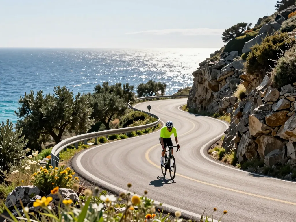
Forget crowded beaches and congested highways. The true essence of the Costa Brava is best experienced on two wheels, where pine scent mingles with salt air. This guide unveils the ultimate road cycling route from Girona’s medieval heart to the sparkling Mediterranean. The journey strings together quiet climbs, dramatic cliffside vistas, and hidden coves reachable only by bike. Whether you’re a seasoned gran fondo rider or a passionate weekend warrior, you’ll find a turn-by-turn breakdown of the roads, the essential elevation profile, and insider tips on where to refuel with local cuisine. By the end, you’ll have everything needed to conquer this iconic stretch of asphalt—and earn the most rewarding descent of your cycling life.
Choosing Your Starting Point in Girona
Central Departure Options
Girona’s compact historic core makes it exceptionally easy to roll out of bed and onto the bike. Two landmarks stand out as ideal launch points: the Girona Cathedral, perched dramatically above the old town, and the lively Plaça de la Independència, a broad, tree-lined square near the Onyar River. These two spots are only a few hundred meters apart, connected by narrow cobbled streets that force a gentle, walkable pace—perfect for warming up your legs and your brakes. Choose the Cathedral if you want a short, steep descent through the Jewish Quarter to the river, or the Plaça if you prefer a flatter, more direct run toward the southern bridges that lead out of town. Both put you within minutes of the main route heading southeast toward the coast, and both offer plenty of café terraces for a pre-ride espresso. If you’re staying outside the center, simply ride to either point as a neutral zone; the real climbing starts once you cross the Aiguaviva road and hit the rolling hills toward Cassà de la Selva.
Pre-Ride Essentials
Before you clip in, do a quick but thorough check. The route to the sea is roughly 45 to 55 kilometers one way, depending on whether you aim for Sant Feliu de Guíxols or Palamós, and while there are villages along the way, services thin out noticeably after Llagostera. Carry at least two full water bottles—summer heat can be intense—and pack a few energy bars or a sandwich, as the best picnic spots are often far from any shop. A basic repair kit is non-negotiable: two spare tubes, tire levers, a multi-tool, and a mini pump or CO2 inflator. The road surfaces are a mix of smooth, fast asphalt on the main climbs and rougher, chip-sealed sections on the quieter farm roads, so punctures are a real possibility. Check your tire pressure before leaving—aim for around 80–90 psi for 25mm tires, or slightly lower if you’re running 28mm or wider. A charged phone with offline maps downloaded (Google Maps or Ride with GPS) is essential, as mobile signal drops in the forested valleys. Finally, apply sunscreen even if it looks cloudy; the coastal wind can deceive you, and the UV exposure builds quickly.
Understanding the Two Main Route Variants
Plotting your course from Girona’s cathedral-shadowed old town to the Mediterranean, you’ll face a genuine fork in the road. Both variants deliver the same essential reward—the salt-tinged air of the Costa Brava—but with distinctly different personalities. The choice comes down to your appetite for solitude versus convenience, and how you feel about climbing.
Northern Variant via Sant Julià de Ramis and Cervià de Ter
This is the road less traveled, and for good reason if you crave quiet tarmac. From Girona, head northeast, crossing the Ter River early on a modern bridge that quickly drops you into flat, fertile agricultural plains. The route through Sant Julià de Ramis and onward to Cervià de Ter is wonderfully uncomplicated—a ribbon of smooth asphalt running straight through sunflowers and maize fields, with the Pyrenees occasionally shouldering the horizon behind you. Though marginally shorter in total distance (roughly 5–8 kilometers less), don’t mistake it for the easier option. As you approach the Gavarres massif from the north, the road begins to roll with short, punchy climbs. These aren’t mountains, but they’ll test your legs after the deceptive flatness of the opening hour. You’ll be rewarded with sparse traffic, a handful of medieval stone villages, and a sense that you’ve discovered the region’s secret back door. Services are sparse—carry extra water, as you might go 20 kilometers without a café.
Southern Variant via Celrà, Bordils, and La Bisbal d’Empordà
This is the classic, and for most riders, the more practical choice. Heading east-southeast from Girona, you’ll pass through the lively suburbs of Celrà and Bordils before emerging onto the broad, open plain of the Baix Empordà. The gradient here is a masterclass in sustainability: a long, gradual false flat that lets you build rhythm without ever feeling like you’re grinding. The centerpiece is La Bisbal d’Empordà, a historic market town famous for its ceramics—you’ll see pottery workshops and kilns right on the main road. It’s the ideal halfway point to stop for a cortado and a slice of coca de recapte. This variant runs slightly longer (add about 10–12 kilometers), but the extra distance buys you genuine infrastructure: frequent gas stations, well-stocked bakeries, and signposted bike shops in case of mechanical issues. The final act, however, is where this route earns its reputation. After La Bisbal, the road tilts upward in a steady, unrelenting ramp through cork oak forests before tipping over the Gavarres’ southern shoulder. The descent to the coast is fast, wide, and exhilarating—a proper reward for the patient climb. If this is your first time making the journey, the southern variant is the prudent, and more memorable, choice.
Terrain Profile and Elevation Gain
Rolling Hills and Short Climbs
The route from Girona’s old town to the Costa Brava is a study in contrasts, yet the terrain is far from punishing. Most variants involve a total elevation gain of roughly 300 to 600 meters, placing this firmly in the “moderate” category—accessible for a well-prepared enthusiast, but with enough undulation to keep things interesting. The opening kilometers out of Girona are deceptively flat, rolling gently through the plain of the Ter River, where you can find a rhythm before the road begins to wrinkle. Heading southeast, expect a series of short, punchy climbs—often no more than 1 to 2 kilometers at a 4–6% gradient—that rise and fall through cork oak groves and quiet farmlands. These are not alpine passes; they are rhythm-breakers, designed to make you shift gears and stand on the pedals for a few minutes before rewarding you with a swooping descent.
If you cut through the Gavarres massif on local roads instead of the more direct coastal highway, the profile sharpens noticeably. The tarmac narrows, the shade thickens, and a few steeper pitches—touching 8–10% for short bursts—will test your legs. The surface is generally good, though expect occasional patches of gravel or leaf litter after rain. This is the heart of the ride, where elevation gain accumulates quietly. The climbs are never long enough to feel relentless, but they are frequent enough that you should pace yourself, keeping something in reserve for the finale.
The Final Approach to the Sea
The last 5 to 10 kilometers before the Mediterranean are where the route exhales. The road tilts downward in a gentle, almost imperceptible descent, losing the last of its height as it funnels you toward the coast. This is a rewarding finish—the gradient is forgiving, often hovering around 1–2%, allowing you to spin a big gear and let speed build without hard braking. The landscape opens up, with pine trees thinning to reveal glimpses of blue on the horizon. But do not let the ease of this section lull you into complacency. As you approach open coastal areas—particularly around the bays near Sant Feliu de Guíxols or Platja d’Aro—crosswinds become a real factor. A strong maritime breeze can push you sideways, especially on exposed stretches where the road hugs the shoreline. Keep a firm grip on the bars, stay alert for gusts funneling through gaps in the cliffs, and tuck in behind a companion if you have one. The reward is a flat, sun-warmed arrival at sea level, where the only remaining task is to find a café with a terrace facing the water.
Key Roads and Quiet Alternatives
Main Roads vs. Local Roads
The most direct asphalt from Girona’s cathedral-shadowed old town to the sea funnels you onto the C-66, a broad and efficient artery that slices toward the Costa Brava. It gets the job done, but commuter traffic and the occasional heavy truck can sap the joy from a day meant for coastal reverie. For a genuinely immersive ride, abandon the main drag at the first sensible junction and pick up the GI-644 or GI-651. These parallel local roads weave through the flat, golden expanse of the Empordà countryside, passing sleepy hamlets like Sant Julià de Ramis and Cervià de Ter, where life moves at the pace of a slow-turning windmill. The pavement is surprisingly smooth, often freshly rolled, and traffic is sparse—mostly tractors, the odd postal van, and other cyclists in on the secret. You’ll trade the roar of engines for the rustle of cornfields and the distant clang of church bells. The extra few kilometres are a bargain for the solitude and unfiltered views of the Pyrenees looming north. Heading toward the southern beaches around Palamós? The GI-651 offers a more intimate corridor than the parallel GI-664, which tends to carry faster, more impatient drivers during summer weekends.
Crossing the Rivers Ter and Daró
Depending on your chosen variant, the Ter River will greet you early in the ride, often within the first 15 kilometres. The crossing is unremarkable in elevation—a flat, wide bridge that lets you keep your rhythm without a grinding climb. The same applies to the Daró River, which you’ll meet near La Bisbal d’Empordà on the inland route, or later on the southern loop toward Fontanilles. These bridges are practical, sturdy structures, but they demand a slice of caution. After autumn rains or on cool, misty mornings, shaded sections of the bridge decks can collect a slick film of wet leaves or wind-blown sand from nearby fields. Don’t brake hard mid-span; ease off before you hit the metal expansion joints, which become treacherous when damp. A light, steady pedal stroke across keeps your line true. No need to dismount—just treat these crossings as moments to check your surroundings, take a breath, and appreciate that the sea is now only a gentle roll of the tyres away.
Navigating Through Towns and Villages
Choosing between the two main variants of the Girona-to-coast route is as much about the villages you’ll pass through as it is about the riding itself. Each offers a distinct character, and knowing what to expect can shape your day on the bike.
Key Waypoints on the Southern Variant
After leaving Girona’s outskirts, the road rolls gently southeast. Your first settlement is Celrà, a compact town where a handful of cafés cluster around the main square—an ideal spot for a quick espresso before the landscape opens into farmland. Roughly ten kilometres later, Bordils presents a more practical stop: a larger village with a well-stocked supermarket, perfect for grabbing water, fruit, or a pre-packaged sandwich if you’re in a hurry. The real landmark, however, is La Bisbal d’Empordà, which serves as the psychological and physical halfway point. This bustling market town is the largest you’ll encounter on the southern run, and its central avenue is lined with bakeries, bars, and casual restaurants serving hearty empordanet cuisine. Riding mid-morning, the aroma of fresh bread and coffee is almost impossible to resist—and you shouldn’t. A stop here for a pa amb tomàquet with cured ham or a simple plate of local cheese will fuel you for the final push toward the sea. Expect to pay anywhere from €3 to €6 for a coffee and pastry, or €12 to €18 for a sit-down lunch with a drink.
Key Waypoints on the Northern Variant
The northern alternative begins with a short, punchy climb out of Girona to Sant Julià de Ramis, a hilltop village that rewards the effort with a sweeping view back over the city’s red-tiled roofs and the cathedral tower. From there, the road descends into quieter countryside. The next notable point is Cervià de Ter, a small, characterful settlement dominated by a beautifully preserved medieval stone bridge that arches over the river Ter. The small square beside the bridge is a lovely place to pause, though you’ll find only a modest bar here. This is the key difference on the northern route: it is distinctly less populated than its southern counterpart. You’ll cycle through stretches of cork oak groves and sunflower fields where the only signs of life are farm dogs and tractors. As such, plan to carry more supplies—an extra bottle and a few energy bars are wise—or time your ride to coincide with the few rural bars that do exist, often attached to petrol stations or farm shops. These sporadic stops, when you find them, offer simple fare: a cold beer, a bag of crisps, and a friendly nod from the locals, which can feel like a hidden gem after the relative bustle of the southern towns.
Reaching the Coast: Endpoint Options
The final stretch of any ride from Girona to the sea is where the route’s character truly reveals itself. After the rolling hills of the Gavarres or the flat plains of the Baix Empordà, you’ll crest a final rise and catch your first glimpse of the Mediterranean. But which coastal town you aim for will shape the last hour of your ride and the tone of your finish. Three primary endpoints stand out, each offering a distinct experience.
L’Estartit as the Northern Endpoint
For a straightforward, sun-drenched finale, L’Estartit is a classic choice. Sitting roughly 45–50 kilometres from Girona’s centre, this purpose-built resort town is the most direct coastal target. The route is largely flat once you leave the city limits, following quiet country lanes through the cereal fields of the Baix Empordà before crossing the Ter River delta. The approach is gentle, with no significant climbs—ideal if you want to save your legs for a swim rather than a summit push. Upon arrival, you’re rewarded with a long, sandy beach stretching over a kilometre, a well-equipped marina, and, just offshore, the dramatic silhouette of the Medes Islands—a protected marine reserve that’s a haven for divers and kayakers. The town itself is lively in summer, with ample bike parking and plenty of beachfront bars for a post-ride cerveza. If you’re planning a longer loop, you can continue north along the coastal road towards l’Escala, but for a clean, satisfying endpoint, L’Estartit is hard to beat.
Palamós or Pals as Southern Alternatives
Prefer a more substantial town with a working harbour? Palamós is your best bet. Located roughly 55–60 kilometres from Girona, it’s a larger, grittier fishing port with a real sense of daily life. The route here takes you through the cork oak forests of the Gavarres hills, offering a few more undulations than the L’Estartit option but nothing overly taxing. Palamós delivers on services: excellent seafood restaurants along the promenade, a bustling fish market in the morning, and several bike shops if you need a last-minute tube or a mechanical check. It’s a lively, functional endpoint where you can watch the trawlers come in while you refuel.
Alternatively, just a few kilometres further south, Platja de Pals offers the opposite vibe. This is a long, wide, and remarkably quiet beach backed by dunes and pine woods. The village of Pals itself sits inland on a hilltop—a beautifully preserved medieval hamlet worth a detour if you have energy left. The ride into Platja de Pals is flat and fast, and the finish feels remote and natural; the only sounds are waves and wind. Choose Palamós for energy and infrastructure; choose Pals for solitude and a sense of escape. Both are comfortably within a day’s ride from Girona, so the decision comes down to your mood at the water’s edge.
Return Options and Route Planning
Direct Flat Return via the C-66
The simplest way back to Girona is to retrace your outward path along the coast road. Prefer a more direct line? Take the C-66 inland from the coastal plain. This main road is flat, fast, and largely follows the river valley—an excellent choice when fatigue sets in or you’re watching the clock. Expect moderate traffic, especially on weekend afternoons when locals head home from beach towns, so ride single-file and stay alert at roundabouts. The C-66 isn’t scenic like the coast, but it offers a reliable, no-navigation-needed corridor that gets you back to Girona in under an hour from most coastal points. On a tight schedule or facing a stiff wind? This is your pragmatic friend.
Scenic Loop Through the Gavarres Hills
Craving more vertical gain and a genuine sense of adventure? The Gavarres massif delivers a spectacular alternative. Instead of turning back, swing inland through cork-oak forests and granite ridges that separate the coast from the plains. This adds roughly 25–35 kilometers and 800–1,200 meters of climbing, depending on your entry point near Sant Feliu de Guíxols or Palamós. Rewards include quiet, shaded lanes, almost no traffic, and sweeping views down to the Mediterranean from isolated passes. You’ll pass medieval hamlets like Romanyà de la Selva, where a fountain and church offer a perfect water refill. Be warned: this turns your ride into a true loop, not an out-and-back, so carry extra food, a charged phone, and a basic repair kit. The climbs are sustained but never brutally steep; descents are technical with loose gravel in places—take them with caution.
Important Note on Route Type
Crucially, the primary route in this guide is not a loop unless you deliberately choose the Gavarres return. The standard out-and-back along the coast spans roughly 90–110 kilometers round trip, while the Gavarres loop stretches to 130–150 kilometers. Plan your day accordingly, factoring in wind direction—the afternoon sea breeze can be stiff—and your own climbing comfort. Always have a backup plan: know the nearest train station along the coast (such as Caldes de Malavella or Flaçà) in case of mechanical trouble, and check the forecast for afternoon thunderstorms, common in summer. Carry at least two bottles, a rain jacket, and a cue sheet with elevation profiles, as phone signal is patchy in the Gavarres. With this preparation, either return option will leave you satisfied, not stranded.
Practical Tips for a Self-Supported Ride
Food and Water Logistics
On the southern variant toward Sant Feliu de Guíxols or Tossa de Mar, you’re never far from a cold drink or a public fountain. Quaint villages like Llagostera and Cassà de la Selva have small bakeries, bar-tabacs, and square-side fountains where you can top up bottles, grab a quick espresso, or pick up a bocadillo. The northern route toward l’Escala or Roses is a different beast. Once you leave the Gironès plains and climb into the Gavarres or the Albera massif, services become genuinely scarce—sometimes for 20 kilometers or more. Carry at least two full bottles (three on hot days) and a few energy bars or a banana. A compact sandwich from a morning bakery will save you from bonking on a deserted climb. Many small village fountains in Catalonia are potable, but when in doubt, use purification tablets or rely on shop-bought water.
Weather and Wind Considerations
The Costa Brava’s microclimate is fickle. Even when Girona’s inland air is still, the coast can be hammered by a stiff afternoon sea breeze that turns the final flat kilometers into a grind. Far more challenging is the tramontana—a dry, gusty north wind that can blow at 40–60 km/h, especially in the Empordà region. It’s not just a headwind; it’s a sideways shove that can push you into traffic on open roads. Check the forecast (Windy or Meteocat) the night before, and look specifically for wind direction and gusts. If a strong tramontana is predicted, consider reversing the route or starting at dawn to finish before the wind peaks—usually between 14:00 and 18:00. Even on calm days, expect a noticeable sea breeze by late afternoon, so don’t underestimate the last 15 kilometers along the coast.
Navigation and Safety
Don’t rely on memory or phone signals in the hills—they’re patchy. Pre-load GPX files on a cycling computer or a phone with an offline map app like OsmAnd or Komoot. Mark your planned stops (cafés, fountains, viewpoints) in advance, so you’re not tempted to skip hydration. On the C-66, the main road connecting Girona to the coast, traffic moves fast. Local drivers are accustomed to cyclists, but they often pass with only a meter of clearance. Ride defensively: stay in single file, take the lane on narrow descents, and never assume a driver sees you. Wear a high-visibility jersey and attach a rear blinking light, even in full daylight—the contrast between shaded forest sections and bright open coast makes you surprisingly hard to spot. Carry a basic repair kit with two spare tubes, a multi-tool, and a mini pump; bike shops are rare outside the main towns.
Conclusion
This route from Girona to the sea offers more than a workout—it blends Catalan culture, rolling hills, and striking Mediterranean views into a ride that challenges and rewards in equal measure. Whether you’re aiming for a personal best on the climbs or planning a swim at the beach, pace yourself and let the landscape lead. Next steps are straightforward: check your tire pressure, pack a windproof layer for the descent, and head out early to catch morning light over the bay. The coast awaits—point your wheels east and let the road take over.
Frequently asked questions
How long is the typical road cycling route from Girona to the coast?
The most direct route from Girona to the nearest coastal town, like Sant Feliu de Guíxols, is roughly 35–40 km one way. However, most recommended loops add climbs and detours, bringing the total to 80–120 km depending on your start point and chosen coastal segment.
What is the best time of year to ride this route?
Spring (April–June) and autumn (September–October) offer mild temperatures and fewer tourists, ideal for cycling. Summer can be very hot and crowded on the coast, while winter days are short and can bring rain, though clear days are still rideable with proper layers.
What is the elevation profile like on the way to the coast?
You’ll face rolling hills immediately outside Girona, then a mix of short, punchy climbs and descents as you cross the Gavarres massif. The final descent to the coast is often steep and winding, so expect a net elevation gain of 400–700 meters depending on your exact route, with the hardest climb usually within the first 20 km.
Are there any must-see viewpoints or landmarks along the way?
The medieval village of Púbol, with its castle linked to Salvador Dalí, is a popular stop on the inland side. Near the coast, the hermitage of Sant Elm on a hill above Sant Feliu offers panoramic views of the Mediterranean, and the fishing port of Tossa de Mar is a classic turnaround point.
What kind of road surfaces should I expect?
Most of the route uses well-maintained asphalt on secondary roads, but some sections through the Gavarres forest are on narrow, sometimes cracked tarmac with occasional gravel patches. The coastal roads are generally smooth, but be alert for sand, leaves, or debris on corners, especially after wind or rain.
How should I navigate, and is signage reliable?
GPS is your best friend, as many turns are unmarked and local roads can be confusing; download a GPX file from a cycling app or local club. Some sections follow the EuroVelo 8 route, which has occasional blue signs, but don’t rely on them—carry a phone or bike computer with offline maps.
Are there safe places to refill water and eat along the route?
Yes, small villages like Llagostera and Cassà de la Selva have public fountains and bars, usually open in the morning and early afternoon. On the coast, every town has multiple cafés and supermarkets, but note that some inland villages close their shops for siesta (roughly 2–5 PM), so plan your stops accordingly.
What are the main traffic hazards on this route?
The biggest risks are fast-moving cars on the main C-65 road between Girona and Llagostera, so avoid it by using parallel quieter lanes. On the coast, narrow roads with parked cars and pedestrians near beaches require extra caution, especially in summer; also watch for farm tractors on inland roads during harvest season.
Is it feasible to do this route as a loop, and what is a recommended way?
Yes, a classic loop heads south from Girona through Cassà de la Selva, climbs to Sant Feliu de Guíxols, then returns inland via Santa Cristina d’Aro and the quieter roads through Romanyà de la Selva. This loop is about 95 km with roughly 1,100 meters of climbing, and it lets you avoid repeating the same ascent.
What should I carry specifically for this route?
Bring at least two full water bottles (750 ml each) because water sources can be sparse in the Gavarres. Pack a lightweight windproof jacket, as coastal descents can be cool even in summer, and a basic repair kit with spare tubes and a pump—the remote forest sections have no bike shops.