Discover Girona’s Best Kept Secret: The Ultimate Countryside Cycling Loop
Uncover Girona's best-kept secret: a stunning road cycling loop through the countryside. Quiet roads, rolling hills, and scenic villages await.
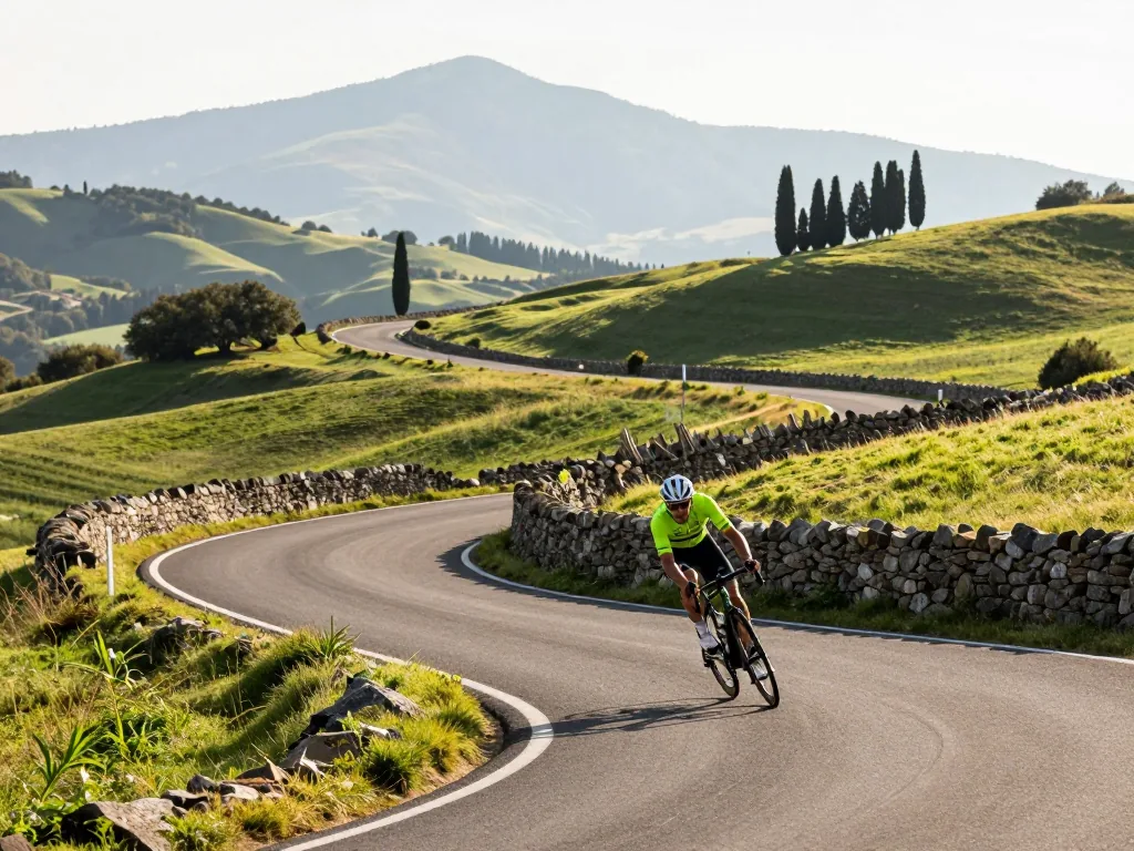
Nestled in the shadow of the Pyrenees and a stone’s throw from the Costa Brava, Girona is already a legend among road cyclists. But while most riders chase the fame of Rocacorba or the cobbles of Els Angels, a quieter, more magical network of lanes waits just beyond the city’s medieval walls. This guide pulls back the curtain on the region’s best-kept secret: a meticulously mapped countryside loop that weaves through cork oak forests, golden wheat fields, and sleepy stone villages, all on near-empty tarmac. Forget the tourist-packed climbs and the race-route hype. Here, you’ll find the pure, unfiltered essence of Catalan cycling—gentle rollers, sweeping descents, and a rhythm that feels like a private escape. By the end, you’ll have the exact turn-by-turn, the hidden café stops, and the insider timing tips to ride this ultimate loop like a local, all without a single car horn or crowded junction.
Understanding the Route and Terrain
The Classic Loop Structure
This isn’t a ride you’ll forget in a hurry. The full loop begins and ends in the heart of Girona, carving a rough ellipse through three distinct comarques: Gironès, Selva, and Baix Empordà. You’re looking at a substantial day in the saddle—roughly 100 to 120 kilometres depending on your exact line—with a cumulative elevation gain that will make your legs honest. The opening third is deceptively gentle: rolling farmland and cork oak groves that lull you into a false sense of ease. Then comes the real conversation. A sustained, multi-kilometre ascent into the Gavarres range awaits, not a switchback-laden Alpine pass but a long, grinding drag with gradients hovering around 5–7%, occasionally pitching steeper on tight, tree-shaded ramps. The reward is a fast, technical descent towards the sea, followed by a glorious coastal section hugging the cliffs near Sant Feliu de Guíxols. Expect wind here—sometimes a helpful tailwind, often a stubborn headwind on the return leg. The final stretch back to Girona rolls fast, but cumulative fatigue makes those last undulations feel sharper than they look on paper.
Key Towns and Waypoints
Your wheels will spin through a handful of towns that matter. Cassà de la Selva, about 20 kilometres south of Girona, is your first real checkpoint—a working Catalan town with a decent bakery if you need to top up supplies. From there, the road bends east towards Llagostera, a charming market town marking the true start of the climbing. Sort your nutrition here. If you’re feeling ambitious and want real teeth in the route, take the optional detour to Romanyà de la Selva. It adds roughly 10 kilometres and an extra 250 metres of climbing, but swaps the main road for a near-empty, sinuous ribbon through the Gavarres’ quietest core—arguably the most beautiful riding in the entire province. The coastal pivot is Sant Feliu de Guíxols, a bustling port town with a striking monastery. You’ll hit this at roughly the halfway mark, and it serves as the natural turnaround. From here, the route shifts west and inland, tracing valley floors back towards Girona. Road quality is generally excellent throughout—smooth asphalt with wide shoulders on busier sections—but be wary of the occasional gravel patch and the ever-present possibility of farm machinery on rural lanes. This loop is best ridden on a standard road bike with a compact chainset; you won’t need a triple, but you’ll be glad for every inch of that 34-tooth inner ring.
Preparing for the Ride
Before you clip in and chase those rolling Catalonian hills, a little honest preparation will separate a sublime day from a sufferfest. This loop isn’t a pro-level ordeal, but it demands respect. Here’s what you need to know before you roll out of Girona’s old town.
Fitness and Experience Level
Moderate fitness is genuinely sufficient—you don’t need to be a racer. But you do need to handle sustained effort. The route throws in several short, punchy climbs that kick up to 10–12% gradients, especially as you weave through cork oak forests toward quieter villages. They’re not Alpine monsters, but steep enough to force you out of the saddle. In the weeks before your trip, practice on similar short, steep ramps—think 3-to-5-minute efforts at threshold, not long grinding climbs. Plan for 4 to 6 hours of saddle time, depending on how many coffee stops you build in. Total elevation gain is manageable, but the constant rolling nature means your legs never fully switch off. If you can ride 80–100 kilometers comfortably with 1,200–1,500 meters of climbing, you’ll finish smiling, not cramping.
Bike Setup and Gear
Your bike choice matters more than your power output. A road bike with compact gearing is non-negotiable. A 34/50 chainset paired with a wide-range cassette (11-32 or 11-34) will keep you spinning on those double-digit ramps instead of grinding to a halt. If you’ve got a standard 39/53 crank, you’ll regret it by kilometer 60. Consider fitting 28mm tires—or wider, if your frame allows—for this specific loop. Girona’s main roads are glassy smooth, but the loop intentionally dips into narrow, rougher farm tracks and older asphalt patches where wider rubber transforms the ride from jittery to plush.
Hydration is critical, especially between May and September when the Mediterranean sun is relentless. Carry two full water bottles at minimum—there are long stretches between villages where fountains are scarce. Pack a basic repair kit: two spare inner tubes, a tire lever set, a multi-tool with chain breaker, and a mini-pump or CO2 inflator. The roads are quiet, but that also means help is far away if you flat. Finally, don’t forget a light windproof gilet, even in summer; the descent from the highest point can be surprisingly cool, and the morning shade in the valleys lingers longer than you’d expect. With this setup, the only thing you’ll need to worry about is where to stop for your second cortado.
Navigation and Route Planning
Using Maps and GPS
Before you set out, download the GPX file for the loop onto your bike computer or phone. The route is well-defined on paper, but the Catalan countryside has a habit of blurring into a patchwork of identical farm tracks and quiet asphalt ribbons. Offline maps are non-negotiable—mobile signal drops to nothing in the valleys between the Gavarres hills, and you will not want to rely on roaming data to find your way back. Pay particular attention at the junctions near Cassà de la Selva and Llagostera. These are the two points where the loop crosses busier local roads, and the signage is minimal: a faded yellow waymarker half-hidden behind a plane tree, or a small stone post that looks like a garden ornament. If you miss the turn, you will add a solid 8–10 kilometres of unnecessary climbing. When in doubt, follow the road that trends gently downhill toward the nearest creek bed—the loop’s logic is to dip into valleys and rise again, never to stay flat for long. A tip from local riders: keep your screen on the “elevation” profile, not just the map. The climbs are short but punchy, and seeing the next ramp coming helps you pace your effort.
Shortening or Extending the Loop
Not every rider wants the full 85-kilometre circuit, and the loop is refreshingly modular. To skip the coastal section—which adds the most wind and the fewest rewarding views if you are short on time—take the R1 train from Girona’s main station to Sant Feliu de Guíxols. The ride from there picks up the loop’s southern arc almost immediately, cutting the distance to roughly 55 kilometres of pure inland terrain. You lose the sea breeze but gain a quieter, more intimate passage through cork oak forests and abandoned farmsteads. If you are hungry for more, extend the route by adding the Romanyà de la Selva climb. It is a 4.5-kilometre ascent at a steady 6–7% gradient, with a summit that rewards you with a panoramic view of the Mediterranean stretching from the Costa Brava to the Pyrenees on a clear day. Alternatively, loop back through the inland villages of Santa Pellaia and Quart instead of following the main descent—this adds 12 kilometres of rolling hills, but you will pass two Romanesque churches and a village square with a public fountain that is perfect for refilling bottles. Whichever option you choose, carry at least one extra water bottle and a basic repair kit; the countryside is beautiful, but services are sparse, and the nearest bike shop is back in Girona.
The Gavarres Climb and Natural Area
The Ascent Profile
The main climb into the Gavarres Natural Area defines the day, rewarding patience over power. From the rolling foothills near Madremanya, the road tilts upward with little warning, shifting from open farmland to a tight, tree-lined corridor within a few hundred meters. The gradient surges and eases rather than holding steady, but the signature sections are the 10–12% ramps that appear just after each false summit. These pitches are short—200 to 400 meters—yet they hit when your legs are already tired from the constant undulation below. Start at a steady, conversational pace; don’t attack the base. Shift into your lowest gear early, well before the road steepens, to avoid stalling mid-ramp. The switchbacks are the crux: they tighten abruptly, and the inside line often hides a steeper pitch than the outside. Save a little energy for these turns, since each exit demands a sharp burst of torque to keep momentum. Once the gradient eases above the treeline, the surface opens to a wide, windswept ridge—but hold off on celebrating. A final false flat of 4–5% leads to the true summit, where the views over the Baix Empordà plain finally unfold.
Riding Through the Protected Forest
The Gavarres isn’t a manicured park; it’s a working Mediterranean forest of cork oaks, holm oaks, and granite outcrops weathered into rounded, moss-covered boulders. The roads are narrow, often single-track with passing spots, and the surface mixes aged tarmac with compacted earth. Expect shade for most of the ascent—a blessing on hot days—but also loose gravel that collects at the pavement’s edges, especially after rain. Don’t hug the white line; ride slightly inward to avoid the fine stones that can skitter under your wheels. There are no services inside the natural area: no fountains, no bars, no mechanics. Carry at least two full bottles and a few gels or bars, since the nearest village on the far side sits at least 12 kilometers from the summit. The descent is technical, not fast. Morning dampness lingers on shaded sections well into late spring, leaving a thin, invisible film of moisture on the asphalt that feels like ice on the first few corners. Brake early, before the apex, and keep your weight low and centered. The reward for this caution is a long, sinuous drop through silent cork groves, where the only sounds are your tires and the occasional crack of a branch—a stretch that feels utterly remote, yet sits just 30 minutes from Girona’s cathedral.
The Coastal Section and Sant Feliu de Guíxols
Approaching the Coast
After the final, winding descent from the Gavarres, the landscape opens up dramatically. Dense cork oak and pine forests yield to terraced hillsides and the salty scent of the Mediterranean. You’ll join the C-253, a ribbon of asphalt hugging the coastline as it curves toward Sant Feliu de Guíxols. Here, the ride shifts character: demanding climbs are behind you, replaced by a rolling, flat-to-undulating stretch with uninterrupted, postcard-perfect views of the deep blue sea to your right. The road is well-maintained, but traffic increases noticeably near town, especially on weekends with beach-bound holidaymakers. Ride defensively—stay visible, keep a straight line, use the hard shoulder where it exists. Your vigilance is rewarded with one of Catalonia’s most scenic coastal cycling stretches, the charming, horseshoe-shaped bay of Sant Feliu unfolding as you descend into town.
Navigating the Town and Return Leg
Sant Feliu de Guíxols is the perfect midpoint reset. The promenade, lined with cafes and bakeries, is ideal for refilling bidons, grabbing a café con leche, and stocking up on a pastry. A quick stop at a local supermercat for water and an energy bar costs €2 to €5 per person. The town itself deserves a moment: the ancient Benedictine monastery of Sant Feliu, with its distinctive Catalan modernist facade, sits right on the seafront—a striking contrast to the fishing boats bobbing in the harbor.
From Sant Feliu, the route turns its back on the sea and heads inland. The initial climb out of town is gentle but persistent, winding through the southern foothills of the Baix Empordà. This is a quieter, more pastoral landscape: summer sunflower fields, vineyards, and stone farmhouses (masías) that have stood for centuries. Gradients are forgiving, perfect for settling into a rhythm and enjoying the scenery. Rather than taking the fast, busy N-II highway back to Girona, follow signs for the GI-664 and GI-662 secondary roads. These meander through small villages like Santa Cristina d’Aro and Llagostera, offering a safer, more pleasant surface with far less motorized traffic. The final leg is a steady, rolling traverse back toward the city, where the flat plains of the Ter river valley signal the approach to Girona’s historic center—completing a loop that balances coastal drama with deep, rural serenity.
Nutrition, Hydration, and Pacing
A ride of this magnitude—roughly 100 to 120 kilometers of undulating Catalan terrain—tests your fueling strategy as much as your legs. Get it right, and the final rolling kilometers into Girona feel like a victory lap. Get it wrong, and the Gavarres will chew you up and spit you out.
Fueling for a 100–120 km Ride
Your engine starts at breakfast. Two to three hours before clipping in, eat a solid meal: porridge with honey, eggs on toast, or a generous bowl of yogurt with granola and fruit. This base layer of complex carbohydrates is non-negotiable. Once rolling, consume 60 to 90 grams of carbohydrates per hour, every hour, from the moment you leave the city limits. Don’t wait for hunger—by then, the deficit is already compounding.
Carry quick-release energy gels for the climbs and slower-burning real food for the flats. Bananas, homemade rice cakes with sea salt, and fig bars are gut-friendly options that won’t spike your blood sugar like pure sugar alone. For hydration, plan bottle refills strategically. Public fountains sit in Cassà de la Selva (roughly 25 km in) and again in Sant Feliu de Guíxols (around the 70 km mark). At each stop, drink a full bottle of water and add an electrolyte tablet to the next one—the sea air and sustained effort make you sweat more than you think.
Pacing Strategy
The first 30 kilometers from Girona to Cassà de la Selva are deceptive: gently rolling farmland that invites you to push hard. Resist. Ride at a strict conversational effort—if you can’t speak in full sentences, you’re going too fast. Warm up and arrive at the base of the Gavarres with fresh legs.
When the road tilts upward into the forested climbs, settle into a steady, sustainable tempo. Stand on the pedals for short bursts to stretch your back, but keep your heart rate in Zone 3. This isn’t a race; it’s a rhythm. As you crest the final pass and drop toward the Mediterranean, the flat coastal stretch toward Sant Feliu de Guíxols is your golden recovery zone. Drop into a big gear, spin easy, eat a rice cake, and let the sea breeze cool your core. Save your final reserves for the undulating hills leading back into Girona—the last 20 kilometers are the quiet killer. Pace them like a time trial, not a sprint, and you’ll arrive at the cathedral feeling strong, not shattered.
Safety, Traffic, and Road Conditions
Road Surface and Shoulder Width
Most of this loop is paved and well-maintained, but don’t expect billiard-smooth tarmac throughout. The first 15 kilometres inland from Girona’s flatlands are wide and forgiving, with clean asphalt and a decent shoulder. Once you climb into the Gavarres hills and descend toward the coast, though, the character shifts abruptly. On several narrow lanes between Llagostera and Santa Cristina d’Aro, the road is barely one-and-a-half car widths wide, with no painted edge line and a crumbling shoulder that drops straight into olive groves or drystone walls. Expect occasional potholes—often hidden in shadow under plane trees—and loose gravel collecting on the outside of tight descents, especially after dry spells or rain. On the fast, winding drop toward Sant Feliu de Guíxols, brake early and keep your weight back; the gravel can send your rear wheel skipping. Near the coast, ride single file, never two abreast, and clip a rear light onto your seatpost even in full daylight. Dappled shade and sharp corners make you less visible to cars approaching from behind, and a blinking red light is the cheapest insurance you can buy.
Traffic Patterns and Hazards
Countryside traffic is genuinely light, especially on weekday mornings—you might share the road with a few local farmers and the occasional post van. That changes dramatically near Sant Feliu de Guíxols, where summer traffic swells with holidaymakers heading to the beaches. Tour buses on the narrow coastal approach take the full lane and will not—and cannot—move over for you. Farm vehicles are a real presence in spring and autumn: tractors towing trailers of cork oak or hay can appear around blind bends, often leaving mud or straw on the asphalt. Watch also for small white delivery vans serving rural restaurants; they drive fast and know every corner intimately. At unsigned junctions where farm tracks meet the main road—especially around Romanyà de la Selva—visibility is often poor, with high hedges or stone walls blocking your view. Signal your turns clearly, long before you brake, and come to a complete stop at any junction where you can’t see both directions. A few of these intersections have no stop signs at all, relying on local knowledge; don’t assume right-of-way. Ride with your head up and hands near the brake levers, and you’ll find the loop challenging but safe.
Seasonal Considerations and Best Times to Ride
The Girona countryside rewards patience and planning. Choosing the right season can transform a good ride into an unforgettable one. The loop is technically rideable year-round, but conditions vary dramatically—knowing when to go ensures you experience the route at its finest.
Spring and Autumn Riding
For most cyclists, the sweet spot lies in the shoulder seasons. From April through June, and again from September through October, the region is at its most hospitable. Daytime temperatures hover in that perfect 15–25°C range: warm enough for short sleeves and sunscreen, cool enough to push hard on climbs without overheating. Rainfall is noticeably lower than in winter, and tarmac dries quickly after a passing shower. More importantly, these months see far fewer visitors. The coastal crowds haven’t arrived in spring and have largely departed by autumn, so you’ll often have the quiet, winding roads almost entirely to yourself. The light is softer, more golden, casting rolling hills and medieval villages in a flattering glow. For the full loop—with its mix of exposed ridgelines and shaded valleys—these are unequivocally the best months to ride.
Summer and Winter Challenges
Summer is a different beast. From late June through August, daytime highs routinely push past 30°C, and the Mediterranean sun beats down relentlessly, especially on the open, treeless sections. The coast, just a short drive away, draws heavy tourist traffic that can spill onto approach roads. If you ride in summer, start before 7 a.m. to beat the worst of the heat, and carry at least two large bottles—refill opportunities are sparse once you leave the villages. A lightweight gilet and sun cream are non-negotiable.
Winter, from December to February, offers a quieter, more contemplative ride, but it comes with caveats. Temperatures are cooler, often hovering between 8–14°C, and rain is more frequent. The route remains passable on dry days, and the crisp air can be invigorating. However, check the forecast carefully and avoid riding after heavy rain. The shaded, north-facing sections accumulate damp leaf litter and a thin layer of moss, which becomes treacherously slippery on descents. Wider tires—28mm or more—with good grip will give you confidence, but even then, caution is warranted. Time it right, and a dry winter’s day offers a peaceful, solitary experience few others will share.
Customizing the Experience
The full loop is a masterpiece of balance—hills, coast, and forest in near-perfect measure—yet it’s remarkably easy to tailor to your legs, your schedule, or your appetite for suffering. The Girona countryside’s network of quiet, paved lanes allows endless permutation without losing the thread of the landscape.
Alternative Variants and Detours
Short on time or prefer a flatter profile? Skip the Gavarres climb entirely. Instead of turning inland, follow the flatter agricultural roads through Cassà de la Selva, a workaday town known for its cork and sausage, and continue straight for the coast. This variant removes the day’s biggest ascent and cuts roughly 12–15 km from the total, leaving more energy for a long lunch by the sea. It’s gentler, but still delivers the same quiet lanes and open skies.
For those who want more, add the Romanyà de la Selva loop. This is the connoisseur’s addition: a 15 km circuit pushing you into the heart of the Gavarres massif, with an extra 400 meters of climbing. The reward is immediate—the road narrows, cork oaks close in overhead, and the air cools with resin and damp earth. The climb is steady rather than brutal, but it will test your pacing. At the top, views over the plain toward the Pyrenees on a clear day are worth every watt.
Local Culture and Stops
Savor this ride; don’t rush it. Plan your morning coffee in Llagostera’s old square, where the arcaded plaza feels unchanged for centuries and the bars serve proper cafè amb llet with a side of local gossip. By midday, aim for Sant Feliu de Guíxols, where the seafront promenade offers everything from a quick bocadillo to a full seafood spread—grilled sardines and esqueixada are house specialties. With an extra hour, detour to the Gavarres interpretation center near Romanyà de la Selva. Housed in a restored stone farmhouse, it tells the story of the cork oak industry that shaped these forests for generations—a fascinating glimpse into why the landscape looks as it does, and a reminder that these woods are as much cultural heritage as natural wonder.
Remember: the loop is about the journey, not just the miles—allow time to enjoy the villages, forests, and sea views.
The Ride Awaits
This hidden loop through the Girona countryside isn’t just a route—it’s your invitation to trade crowded tourist roads for quiet lanes, rolling vineyards, and medieval stone villages that feel frozen in time. The real secret isn’t a single climb or viewpoint, but the way the entire circuit stitches together authentic Catalan landscapes with smooth, low-traffic tarmac. If you’re ready for a ride that rewards effort with solitude and scenery, pull on your cycling shoes, load the GPX file, and set out early from Girona’s edge. Your next step is simple: pick a clear morning, bring plenty of water, and let the loop’s gentle rhythm reveal why locals keep it to themselves.
Frequently asked questions
How long is the typical Girona countryside road cycling loop?
Most loops range from 60 to 120 kilometers, depending on whether you choose the shorter flat route toward the plains or the longer hilly version that climbs into the Gavarres or Rocacorba. A standard half-day loop is around 80–90 km with about 800–1,200 meters of elevation gain.
What is the best time of year to ride this loop?
Spring (April–June) and autumn (September–October) offer mild temperatures, clear skies, and less traffic on rural roads. Summer can be hot, especially on exposed climbs, while winter is cooler but still rideable with proper layers, though occasional rain is possible.
What type of road bike is recommended for this route?
A standard road bike with compact gearing (34/50 chainrings and an 11-32 cassette) is ideal, as some climbs reach 8–10% gradients. Wider tires (28–32mm) are recommended for comfort on the rougher farm roads and occasional gravel sections that appear on some variants.
Are there any significant climbs on the loop?
Yes, the most notable climb is the ascent to Rocacorba (about 8 km at 6–7% average, with steeper ramps), or the shorter but punchy climb to Sant Grau in the Gavarres. The rest of the route is rolling terrain with gentle hills through cork oak forests and farmland.
Where do most riders start the loop from?
Most riders start from Girona city center, heading east toward the villages of Celrà, Bordils, and Sant Joan de Mollet, or south toward Llagostera. Starting from Girona allows you to warm up on flat roads before reaching the hills.
What are the road conditions like on this loop?
The main roads are well-paved and smooth, but many secondary lanes are narrow with occasional patches, cattle grids, or loose gravel at the edges. Traffic is light outside of the main tourist season, but be cautious on the descent from Rocacorba where the surface can be slightly uneven.
Are there good places to refuel or stop for water along the route?
Yes, the small villages of Celrà, Medinyà, and Campllong have basic bars and fountains, but they may close on Sunday afternoons. It’s wise to carry at least two bottles and some snacks, as there are long stretches (20–30 km) with no services.
Is the loop well signposted, or do I need a GPS?
The loop is not officially signposted, so you’ll need a GPS device or a preloaded route on your phone or bike computer. Many local cycling clubs have published GPX tracks for this area, and using a mapping app with offline maps is highly recommended.
What should I be aware of regarding wind and weather on this route?
The plains east of Girona can be exposed to the tramuntana wind, which can make flat sections feel like a headwind slog, especially in winter. Check the forecast before starting, and plan to ride the loop in a clockwise direction if a strong wind is expected, so you finish with a tailwind on the return.
Are there any cultural or scenic highlights along the loop?
You’ll pass medieval villages like Peratallada (if you extend the route), the Romanesque monastery of Sant Miquel de Cruïlles, and panoramic views of the Pyrenees from the higher points. The route also crosses the Ter River and winds through fields of sunflowers in late summer, making it visually rewarding beyond just the cycling.